|
|
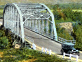
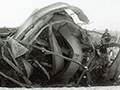
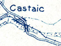
Castaic & Saugus
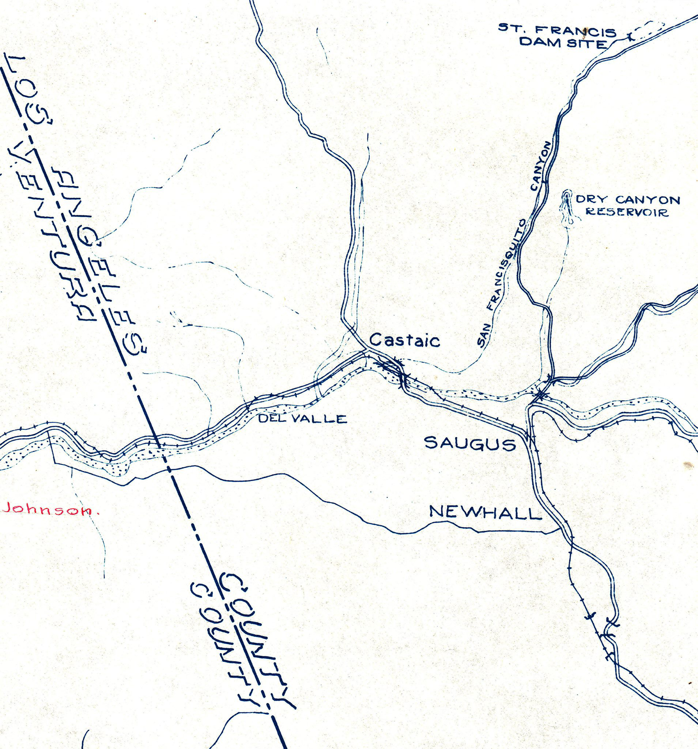
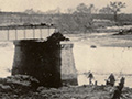
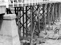
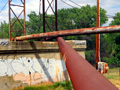
Click image to enlarge Map: Bridges in Los Angeles County washed away in the flood from the St. Francis Dam Disaster of March 12-13, 1928. On west: Metal-truss auto bridge over the Santa Clara River at Castaic Junction; Auto bridge over San Francisquito Creek where it meets the Santa Clara River; Auto bridge over Southern Pacific Railroad tracks. On east: Bridge over Santa Clara River; bridge over Bouquet Creek where it meets the Santa Clara River.
RO2802: 19200 dpi jpeg from collection of J. David Rogers. |
|
[ RETURN TO TOP ]
[ RETURN TO MAIN INDEX ]
[ PHOTO CREDITS ]
[ BIBLIOGRAPHY ]
[ BOOKS FOR SALE ]
SCVHistory.com is another service of SCVTV, a 501c3 Nonprofit • Site contents ©SCVTV
The site owner makes no assertions as to ownership of any original copyrights to digitized images. However, these images are intended for Personal or Research use only. Any other kind of use, including but not limited to commercial or scholarly publication in any medium or format, public exhibition, or use online or in a web site, may be subject to additional restrictions including but not limited to the copyrights held by parties other than the site owner. USERS ARE SOLELY RESPONSIBLE for determining the existence of such rights and for obtaining any permissions and/or paying associated fees necessary for the proposed use.
The site owner makes no assertions as to ownership of any original copyrights to digitized images. However, these images are intended for Personal or Research use only. Any other kind of use, including but not limited to commercial or scholarly publication in any medium or format, public exhibition, or use online or in a web site, may be subject to additional restrictions including but not limited to the copyrights held by parties other than the site owner. USERS ARE SOLELY RESPONSIBLE for determining the existence of such rights and for obtaining any permissions and/or paying associated fees necessary for the proposed use.
