|
|
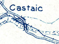
Castaic Junction | St. Francis Dam Disaster
Click image to enlarge
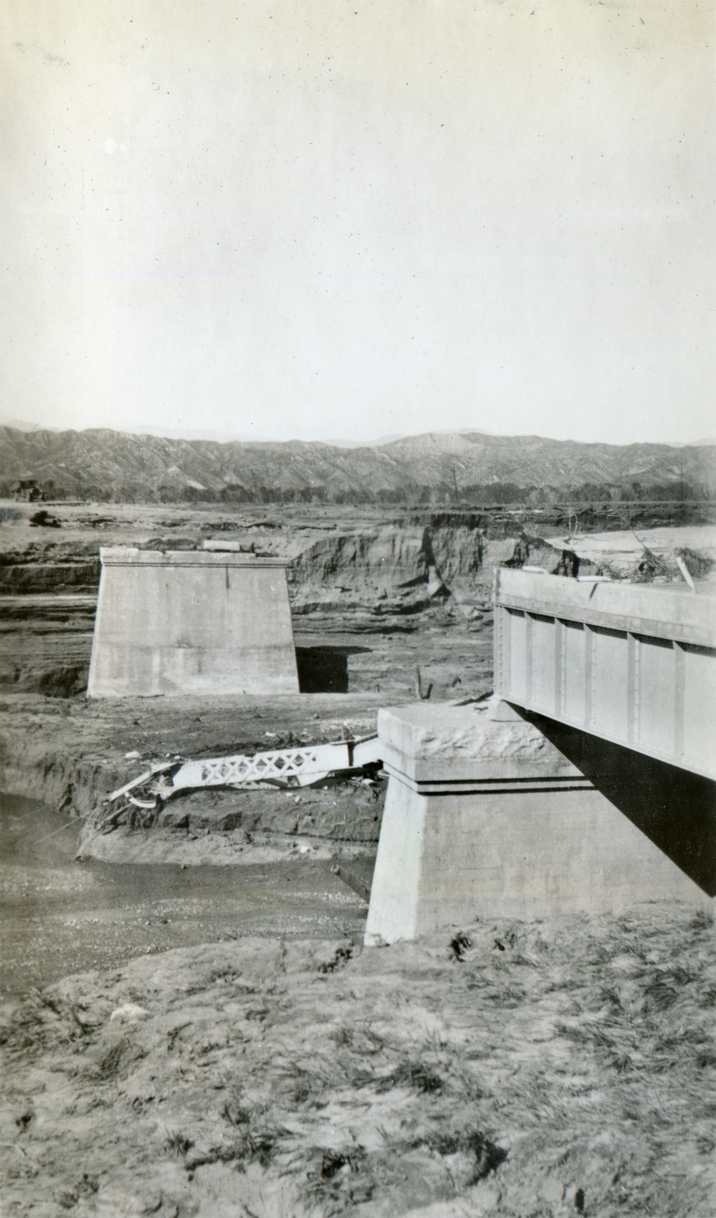
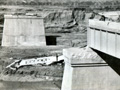
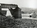
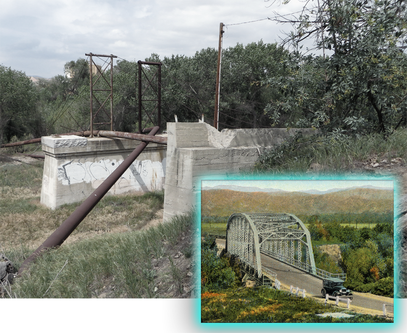
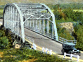
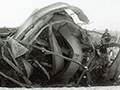
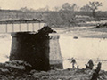
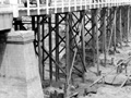
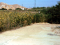
The concrete supports were all that was left of a metal-truss auto bridge at Castaic Junction after the floodwaters of the St. Francis Dam disaster swept it away in the early morning hours of March 13, 1928. The bridge spanned the Santa Clara River and was part of the highway between Saugus and Castaic. It can be seen in its original form in an early 1920s picture postcard by Western Publishing & Novelty Co. According to Ridge Route historian Harrison Scott (2002:90), the postcard publisher mislabeled it Castaic Creek. Scott (ibid.:94) also notes that the "Ridge Route" officially started at State Route 126 on the south; this bridge was just south of that. In modern context, the bridge supports are located west of Interstate 5, north of Feedmill Road (the Magic Mountain amusement park employee access road) and immediately south of the Santa Clarita Valley Sanitation District's Valencia Water Reclamation Plant.
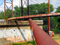
A map provided by Rogers shows that the dam disaster took out three bridges in close proximity to one another: this one; an auto bridge just north of it, over San Francisquito Creek where it feeds into the Santa Clara River; and a highway crossing over the Southern Pacific Railroad tracks. (The same map also shows two additional washed-out bridge locations northeast of Saugus.) Today (2014) the concrete supports of this old bridge don't support vehicular traffic, but they still serve a purpose. They keep various utility pipes out of the river. None of the metal structures seen today has anything to do with the original bridge; the pipes lead to and from the adjacent sewage treatment plant, which was built in 1967 to an initial capacity of 1.5 million gallons per day. As of 2014, the 27-acre facility processes 21.6 million gallons of wastewater daily. According to historian Don Ray, the round metal structure with spokes and barbed wire, seen in some of the photographs, was installed to prevent people from crawling along the pipes to cross the river.
Source: Photograph from the Edward C. Lamb collection, believed to have been created by his brother Henry C. Lamb. Henry's name alone is associated with this set of 30 St Francis Dam Disaster photos. Henry C. Lamb was a graduate of Stanford University who worked for the Edison company. His descendants report (2014) that they do not believe he was present at the Edison camp at Kemp at the time of the disaster. Although they suspect Henry shot the photgraphs himself, it is possible he received them from a third party.
Construction on the 600-foot-long, 185-foot-high St. Francis Dam started in August 1924. With a 12.5-billion-gallon capacity, the reservoir began to fill with water on March 1, 1926. It was completed two months later. At 11:57:30 p.m. on March 12, 1928, the dam failed, sending a 180-foot-high wall of water crashing down San Francisquito Canyon. An estimated 411 people lay dead by the time the floodwaters reached the Pacific Ocean south of Ventura 5½ hours later. It was the second-worst disaster in California history, after the great San Francisco earthquake and fire of 1906, in terms of lives lost — and America's worst civil engineering failure of the 20th Century.
EJ2807: 19200 dpi jpeg from original 2.5x4-inch print. Archival scan on file. |
|


The site owner makes no assertions as to ownership of any original copyrights to digitized images. However, these images are intended for Personal or Research use only. Any other kind of use, including but not limited to commercial or scholarly publication in any medium or format, public exhibition, or use online or in a web site, may be subject to additional restrictions including but not limited to the copyrights held by parties other than the site owner. USERS ARE SOLELY RESPONSIBLE for determining the existence of such rights and for obtaining any permissions and/or paying associated fees necessary for the proposed use.
