|
|
St. Francis Dam: S.F. Ranch Orchard
St. Francis Dam Disaster
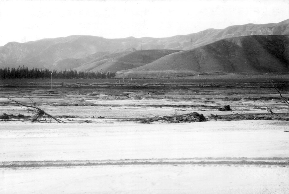
Photo No. 25 from The Newhall Land and Farming Co.'s March 24, 1928 report on the March 12-13 St. Francis Dam Disaster.This photo, "taken from the south bridgehead of the Ranch bridge on the road leading from the highway to the Orchard Ranch Houses shows the desolate waste now left between it and the State Highway on the north, also in the foreground how the bed of the living stream was moved about 300 feet north and 6 to 8 feet lower than when it formerly ran under the Ranch bridge."
Original caption by Almer M. Newhall reads as follows:
No. 25 Looking north from south bridgehead of Ranch Bridge.
From Plate VIII.
[ RETURN TO TOP ]
[ RETURN TO MAIN INDEX ]
[ PHOTO CREDITS ]
[ BIBLIOGRAPHY ]
[ BOOKS FOR SALE ]
SCVHistory.com is another service of SCVTV, a 501c3 Nonprofit • Site contents ©SCVTV
The site owner makes no assertions as to ownership of any original copyrights to digitized images. However, these images are intended for Personal or Research use only. Any other kind of use, including but not limited to commercial or scholarly publication in any medium or format, public exhibition, or use online or in a web site, may be subject to additional restrictions including but not limited to the copyrights held by parties other than the site owner. USERS ARE SOLELY RESPONSIBLE for determining the existence of such rights and for obtaining any permissions and/or paying associated fees necessary for the proposed use.
The site owner makes no assertions as to ownership of any original copyrights to digitized images. However, these images are intended for Personal or Research use only. Any other kind of use, including but not limited to commercial or scholarly publication in any medium or format, public exhibition, or use online or in a web site, may be subject to additional restrictions including but not limited to the copyrights held by parties other than the site owner. USERS ARE SOLELY RESPONSIBLE for determining the existence of such rights and for obtaining any permissions and/or paying associated fees necessary for the proposed use.
