|
|
St. Francis Dam: Blue Cut Area
St. Francis Dam Disaster
[Full View][Closeup of Erosion]
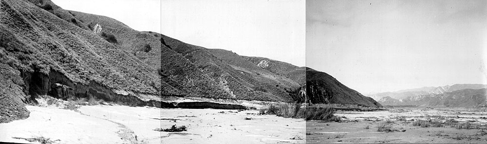
Photo No. 21 from The Newhall Land and Farming Co.'s March 24, 1928 report on the March 12-13 St. Francis Dam Disaster.West of the decimated Edison Construction Camp, opposite the Blue Cut Promontory on the south bank of the river, "the water seems to have attained its greatest depth anywhere on the Ranch and as near as we could judge it reached a height of something like 60 feet. (This photo) shows the level of the flood water above the river bottom by the white line along the hillside just as clearly as though a gang had gone in and cleaned out all the brush and vegetation on a line marked out by surveyors."
Original caption by Almer M. Newhall reads as follows:
No. 21 South side of river opposite Blue Cut Promontory.
From Plate VII.
[ RETURN TO TOP ]
[ RETURN TO MAIN INDEX ]
[ PHOTO CREDITS ]
[ BIBLIOGRAPHY ]
[ BOOKS FOR SALE ]
SCVHistory.com is another service of SCVTV, a 501c3 Nonprofit • Site contents ©SCVTV
The site owner makes no assertions as to ownership of any original copyrights to digitized images. However, these images are intended for Personal or Research use only. Any other kind of use, including but not limited to commercial or scholarly publication in any medium or format, public exhibition, or use online or in a web site, may be subject to additional restrictions including but not limited to the copyrights held by parties other than the site owner. USERS ARE SOLELY RESPONSIBLE for determining the existence of such rights and for obtaining any permissions and/or paying associated fees necessary for the proposed use.
The site owner makes no assertions as to ownership of any original copyrights to digitized images. However, these images are intended for Personal or Research use only. Any other kind of use, including but not limited to commercial or scholarly publication in any medium or format, public exhibition, or use online or in a web site, may be subject to additional restrictions including but not limited to the copyrights held by parties other than the site owner. USERS ARE SOLELY RESPONSIBLE for determining the existence of such rights and for obtaining any permissions and/or paying associated fees necessary for the proposed use.
