|
|
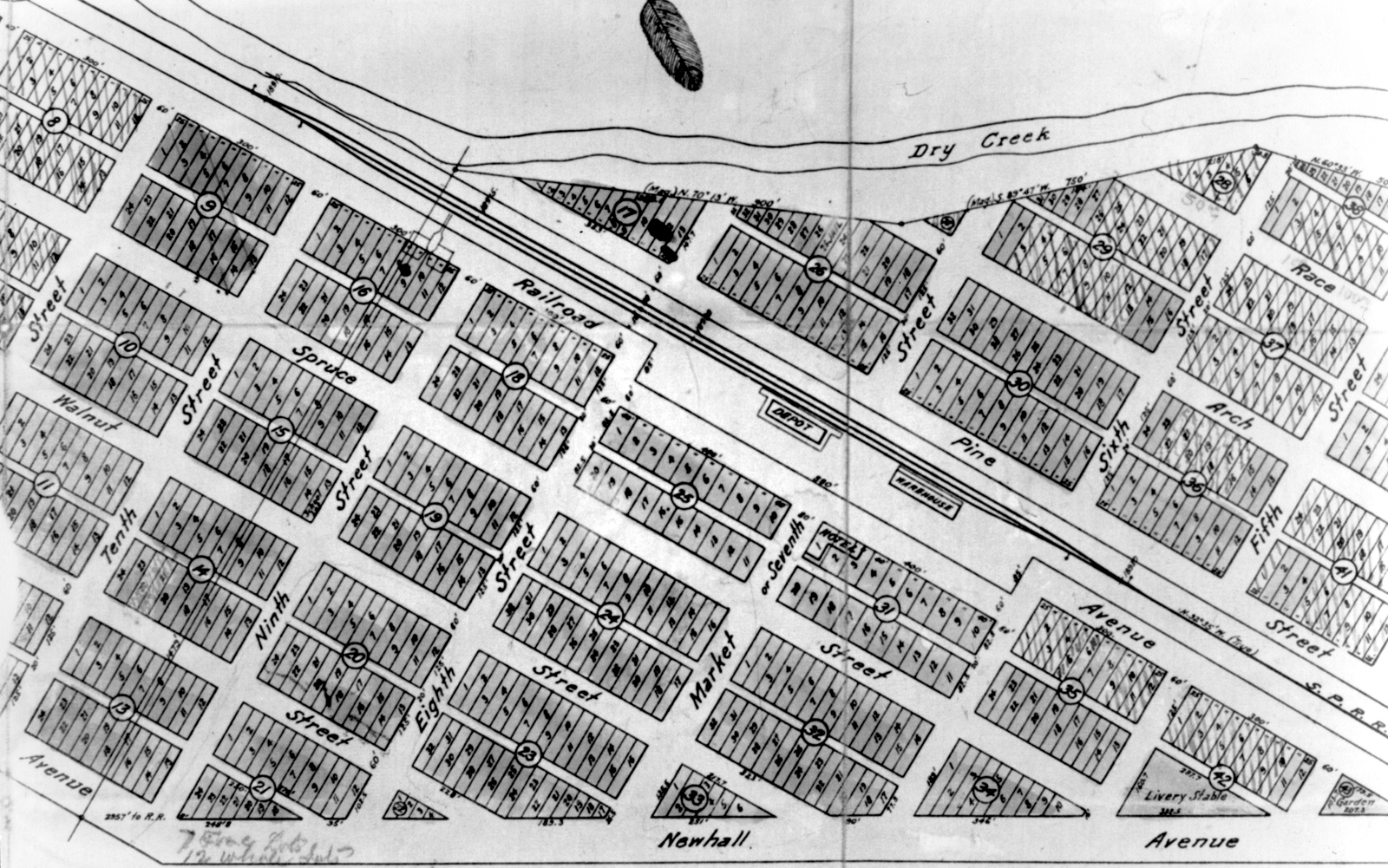
Plat Map, 1889
Newhall, California
Click image to enlarge
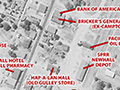
This plat map of downtown Newhall, dated 1889, pinpoints the location of the Southern Pacific Railroad's Newhall depot at the northeast corner of Railroad Avenue and Market Street. Spruce Street, one block to the west, was realigned in the 1920s and became San Fernando Road (renamed "Main Street" in 2007). Tenth Street, also known as Pico Road, became Lyons Avenue. The map also shows the layout of the Southern Hotel across three parcels at the southwest corner of Railroad Avenue and Market Street. The hotel burned down two years earlier.
AP2632: 12800 dpi jpeg from copy print |
1889 Plat
1892 Sanborn Map
SPRR Right of Way, Property Transactions 1876-1992
Aerial 1930, Labeled
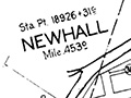
Newhall 10/31/1964
|

[ RETURN TO TOP ]
[ RETURN TO MAIN INDEX ]
[ PHOTO CREDITS ]
[ BIBLIOGRAPHY ]
[ BOOKS FOR SALE ]
SCVHistory.com is another service of SCVTV, a 501c3 Nonprofit • Site contents ©SCVTV
The site owner makes no assertions as to ownership of any original copyrights to digitized images. However, these images are intended for Personal or Research use only. Any other kind of use, including but not limited to commercial or scholarly publication in any medium or format, public exhibition, or use online or in a web site, may be subject to additional restrictions including but not limited to the copyrights held by parties other than the site owner. USERS ARE SOLELY RESPONSIBLE for determining the existence of such rights and for obtaining any permissions and/or paying associated fees necessary for the proposed use.
The site owner makes no assertions as to ownership of any original copyrights to digitized images. However, these images are intended for Personal or Research use only. Any other kind of use, including but not limited to commercial or scholarly publication in any medium or format, public exhibition, or use online or in a web site, may be subject to additional restrictions including but not limited to the copyrights held by parties other than the site owner. USERS ARE SOLELY RESPONSIBLE for determining the existence of such rights and for obtaining any permissions and/or paying associated fees necessary for the proposed use.
